Marine Projects Dataregister
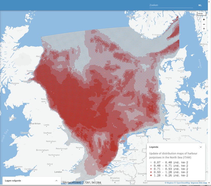
Update of distribution maps of harbour porpoises (bruinvis) in the North Sea 2020 (ITAW)
This project aimed to update density surface layers for harbour porpoises in the North Sea by enlarging an existing database from the period 2005-2013 (Gilles et al. 2016) with dedicated aerial survey data from 2014-2019. The results of a model study are presented in this viewer.
Simple
- Date ( Publication )
- 2024-01-01
- Status
- Completed
- GEMET - INSPIRE themes, version 1.0
-
-
harbour porpoise
-
bruinvis
-
- Use constraints
- Other restrictions
- Other constraints
- Geen condities voor toegang en gebruik
- Access constraints
- Other restrictions
- Use limitation
-
Open Access, CCby
- Denominator
- null
- Metadata language
- Nederlands; Vlaamsnl
- Topic category
-
- Biotisch
- Zeezoogdieren
- Distribution format
-
-
gml+xml
(
3.2.1
)
-
gml+xml
(
- OnLine resource
-
prediction_Su_2014-2019_epsg25831
(
OGC:WMS
)
- OnLine resource
-
prediction_Su_2014-2019_epsg25831
(
OGC:WFS-1.0.0-http-get-capabilities
)
- Hierarchy level
- Dataset
Conformance result
- Date ( Publication )
- 2010-12-08
- Explanation
-
This data set is conformant with the INSPIRE Implementing Rules for the interoperability of spatial data sets and services
- Pass
- Yes
- Statement
-
This project aimed to update density surface layers for harbour porpoises in the North Sea by enlarging an existing database from the period 2005-2013 with dedicated aerial survey data from 2014-2019. The results of a model study are presented. Project: carried out by ITAW..